
By Onyekachi Victoria Philip
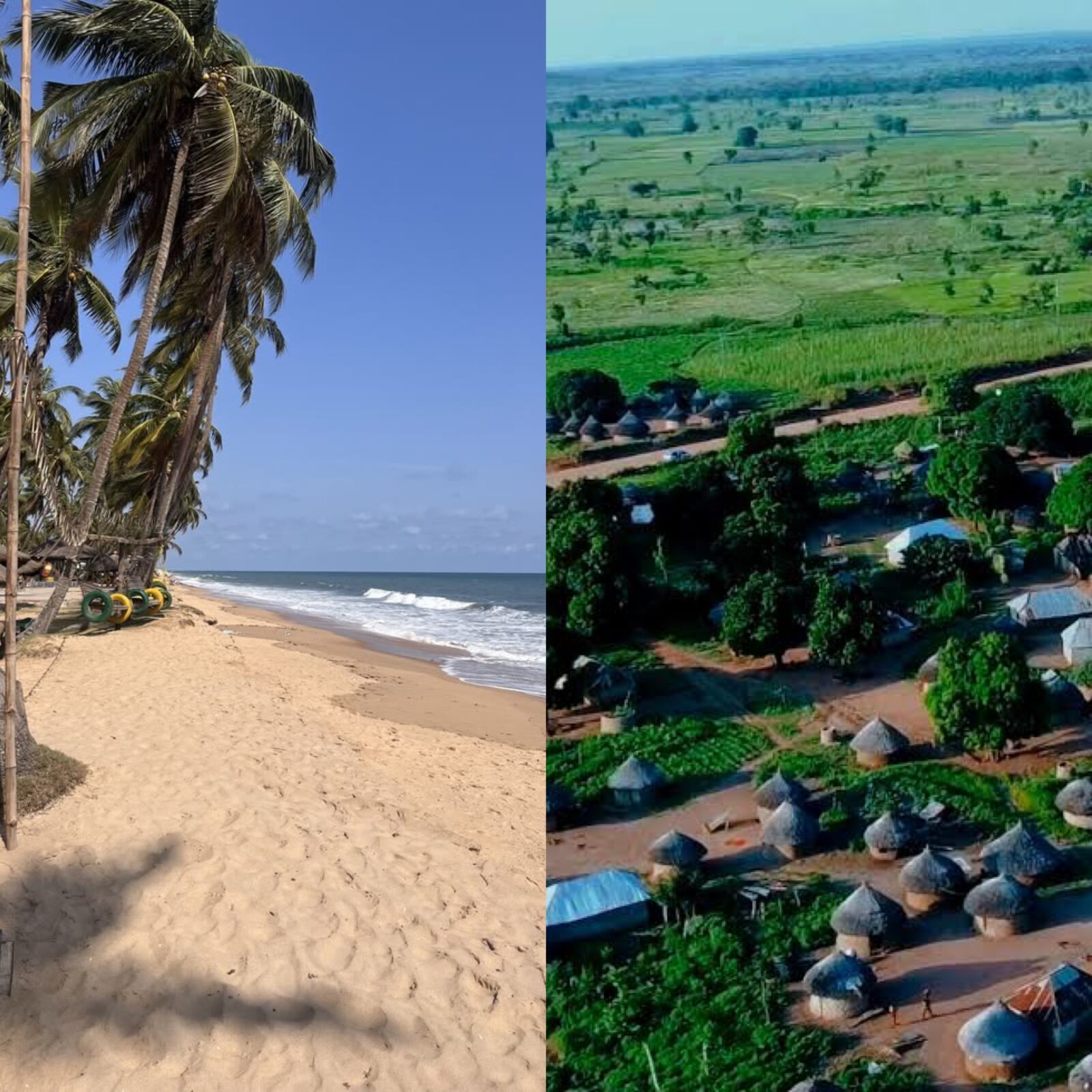
Nigeria’s geography changes dramatically from north to south. In the north, wide open landscapes of grasses, scattered trees and seasonal dryness dominate much of the terrain, while farther south, the country gradually enters wetter environments of forests, wetlands, mangroves, lagoons and, eventually, the Atlantic coastline.
What exactly does “savannah” mean?
A savannah is a grass-dominated ecosystem in which grasses grow alongside scattered trees and shrubs, rather than the dense, continuous tree cover associated with tropical rainforest. Its appearance is strongly connected to rainfall, temperature, soil and the length of the dry season.
Savannah is therefore not simply a grassland, it is a distinct ecological environment capable of supporting wildlife, livestock, agriculture and communities adapted to its climate.
Across West Africa, vegetation generally changes in broad belts as rainfall decreases away from the humid coast. The U.S. Geological Survey describes the region as a progression from the humid Guineo-Congolian zone through the Guinean, Sudanian and Sahelian zones toward the Sahara.
Why is savannah so prominent in northern Nigeria?
The major reason is rainfall.
As one moves inland from Nigeria’s southern coast, the influence of the humid Atlantic environment decreases and the climate becomes progressively drier. Nigeria’s vegetation is closely linked to this climatic pattern.
Vegetation distribution depends largely on climate and that the climate becomes drier with increasing distance from the sea.
That creates the conditions under which grasses can dominate while trees become more widely spaced.
The northern part of Nigeria consequently contains several savannah belts rather than one single type. These include:
Sahel Savanna – the driest of the major Nigerian savannah environments, found particularly toward the extreme north.
Sudan Savanna – a somewhat wetter belt south of the Sahel.
Northern Guinea Savanna – found farther south and generally supporting more vegetation.
Southern Guinea Savanna – extending into parts of the Middle Belt.
Nigeria’s ecological classification confirms this north-to-south progression, with Sahel and Sudan savannah in the northern areas and Guinea savannah extending farther toward central Nigeria.
So, savannah is not found only in northern Nigeria. It is most strongly associated with the north, but Guinea savannah extends into the Middle Belt and some savannah landscapes also occur farther south as derived savanna. Nigeria’s ecological zones include savannah, rainforest, swamp and mangrove environments.
Where are Nigeria’s savannah zones found?
Broadly, the Guinea Savanna stretches across much of Nigeria’s Middle Belt and parts of the north-central and north-eastern regions. It includes significant areas of:
- Taraba
- Adamawa
- Gombe
- Bauchi
- Kaduna
- Niger
- Plateau
- Benue
- Kogi
- Kwara
- Nasarawa
- Niger
There are also transitional or smaller Guinea-Savanna areas in some neighbouring states, depending on the ecological classification being used.
Sahel Savanna: parts of Yobe, Borno, Jigawa, Sokoto and Kebbi, particularly their drier northern areas.
Sudan Savanna: large portions of Borno, Yobe, Jigawa, Kano, Katsina, Zamfara, Sokoto, Kebbi, Kaduna, Bauchi and Gombe.
Northern Guinea Savanna: areas extending through parts of Kaduna, Kano, Katsina, Zamfara, Kebbi and adjoining areas.
Southern Guinea Savanna: much of Niger State and parts of the central Nigerian landscape, with the ecological transition continuing into other Middle Belt areas.

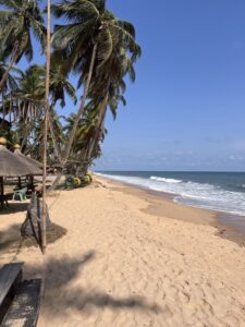
And then there is the Atlantic
Nigeria’s southern edge meets the Atlantic Ocean through the Gulf of Guinea. The U.S. Department of State describes Nigeria as having a maritime boundary with the Gulf of Guinea, which forms part of the Atlantic Ocean.
This is why the ocean is particularly associated with Nigeria’s southern coastal environment rather than the northern interior, the shape and geological position of Nigeria place its coastline at the southern edge of the country.
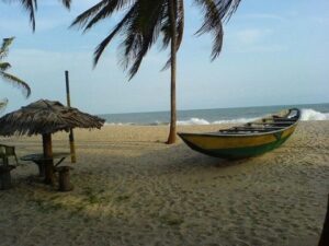
The Nigerian coast stretches for roughly 853 kilometres, encompassing several different coastal environments. The Niger Delta alone accounts for approximately 450 kilometres of that coastline and contains extensive mangrove ecosystems.
The Atlantic-facing coastline includes areas associated with states such as Lagos, Ogun, Ondo, Delta, Bayelsa, Rivers, Akwa Ibom and Cross River, although the character of the coast varies considerably from beaches and lagoons to estuaries, wetlands and mangrove systems.
Bayelsa, for example, lies within the Niger Delta and has the Atlantic Ocean along its southern boundary. Rivers State is likewise bounded by the Atlantic Ocean to the south.
Why don’t the savannah and Atlantic Ocean exist in the same way everywhere?
It is not that nature deliberately separated them. Climate, latitude, distance from the ocean, rainfall patterns, landforms and drainage created different ecological conditions across Nigeria.
The north is farther from the Atlantic’s humid coastal influence and experiences a longer dry season with substantially lower rainfall. The south receives much more moisture and contains extensive lowland forests, freshwater wetlands, swamps and mangrove environments.
That is why a journey across Nigeria can feel like travelling between different natural worlds, the open grasslands of the northern savannah gradually give way to greener landscapes and eventually to the wet coastal ecosystems of the south.
The Atlantic itself was obviously not discovered in Nigeria, the ocean existed long before human records. What changed was European maritime exploration and the mapping and recording of the West African coast.
Portuguese maritime exploration reached the West African coastline centuries ago during the period of Portuguese expansion along Africa’s Atlantic coast.
By the late 15th century, Portuguese navigators were interacting with coastal societies in the region that is now Nigeria, particularly around the Niger Delta and the Kingdom of Benin.
The coastline subsequently became increasingly important for trade and international contact, eventually becoming part of the wider history of European commerce, the transatlantic slave trade and later colonial expansion.
Today, that same geographical position gives Nigeria access to the Gulf of Guinea and the wider Atlantic maritime system, while the country’s inland north remains shaped by a very different climatic and ecological reality.
In geographical terms, Nigeria’s beauty is partly in this contrast, the north’s savannahs reveal what happens when rainfall decreases across the interior, while the southern coast demonstrates what happens where land meets the humid Atlantic environment. They are not competing landscapes, they are different expressions of the same country’s geography.